![](/images/other/stat-length.png)
![Trail On foot Praia (São Mateus) - Volta à Caldeira - Furna do Enxofre - Photo](https://media.geolcdn.com/t/1900/400/ext.pjpeg?maxdim=2&url=https%3A%2F%2Fmedia.geolcdn.com%2Ff%2F94482e97-8c3d-4523-9123-80bbb2c0482e.jpeg)
Volta à Caldeira - Furna do Enxofre
SityTrail - itinéraires balisés pédestres
Tous les sentiers balisés d’Europe PRO
![Length](/images/other/stat-length.png)
Length
5.8 km
![Max alt](https://static1.geolcdn.com/siteimages/upload/files/1508320355ic_sort_altitude_max_24dp.png)
Max alt
309 m
![Uphill gradient](https://static1.geolcdn.com/siteimages/upload/files/1508320355ic_sort_den_pos_24dp.png)
Uphill gradient
189 m
![Km-Effort](/images/other/stat-length.png)
Km-Effort
8.1 km
![Min alt](https://static1.geolcdn.com/siteimages/upload/files/1508320355ic_sort_altitude_min_24dp.png)
Min alt
162 m
![Downhill gradient](https://static1.geolcdn.com/siteimages/upload/files/1508320355ic_sort_den_neg_24dp.png)
Downhill gradient
135 m
![Boucle](https://static1.geolcdn.com/siteimages/upload/files/16400158638029165_repeat_loop_refresh_sync_direction_icon.png)
Boucle
No
Signpost
Creation date :
2022-02-14 14:44:30.445
Updated on :
2022-02-14 14:44:30.445
![On foot](https://static1.geolcdn.com/sitytour/trail-icons/100.png)
1h50
Difficulty : Easy
![Scan this QR Code to open this trail in the SityTrail application](https://capi.geolives.com/qq0zvz2zws4bq2lad0pu/sitytour/trails/3109179/qr.png?size=200)
FREE GPS app for hiking
About
Trail On foot of 5.8 km to be discovered at Azores, Unknown, Praia (São Mateus). This trail is proposed by SityTrail - itinéraires balisés pédestres.
Description
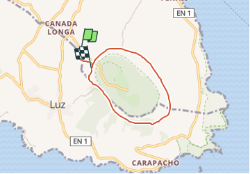
Discover the hiking route PRC2GRA Volta à Caldeira - Furna do Enxofre. View the map and download the GPS track.
Website: http://trails.visitazores.com/en/trails-azores/graciosa/volta-caldeira-furna-do-enxofre
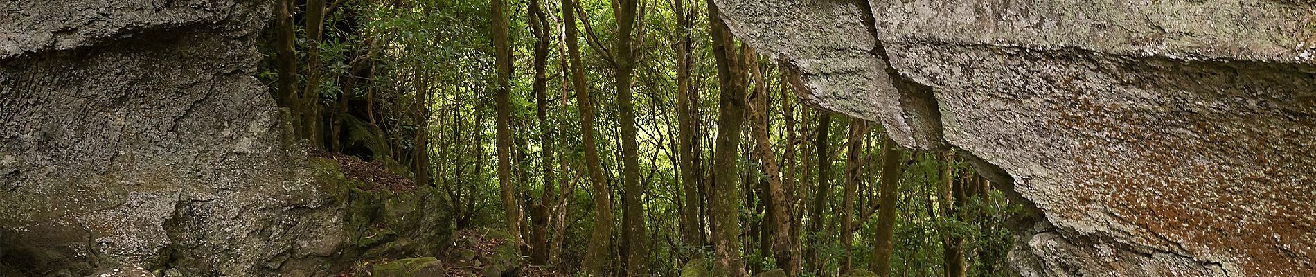
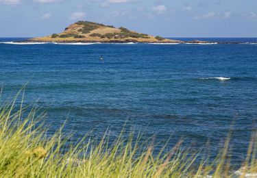
Positioning
Country:
Portugal
Region :
Azores
Department/Province :
Unknown
Municipality :
Praia (São Mateus)
Location:
Unknown
Start:(Dec)
Start:(UTM)
414795 ; 4320844 (26S) N.
Comments
Trails nearby
![Trail On foot Guadalupe - Serra Branca - Praia - Photo](https://media.geolcdn.com/t/375/260/ext.jpg?maxdim=2&url=https%3A%2F%2Fmedia.geolcdn.com%2Ff%2F744dc27f-b6b7-4ebc-8677-24bbcb7ae056.jpeg)
![On foot On foot](https://static1.geolcdn.com/sitytour/trail-icons/100.png)
Serra Branca - Praia
On foot
Easy
Guadalupe,
Azores,
Unknown,
Portugal
![](/images/other/stat-length.png)
8.7 km | 11 km-effort
2h 29min
![](https://static1.geolcdn.com/siteimages/upload/files/16400158638029165_repeat_loop_refresh_sync_direction_icon.png)
No